Smart Mining
Smart Mining
By integrating location-based IoT and GIS visualization technologies, our system intelligently analyzes diverse data. This enables managers to have a comprehensive view of personnel and vehicle spatial positions throughout the entire underground area on a large screen. Real-time safety alerts and intelligent emergency status control enhance the level of safety management.

Highlights
Real-time Monitoring Above and Below Ground
Real-time tracking of personnel and vehicles above and below ground. A unified platform for positioning data, displaying all locations on one map. Supports 2D/2.5D/3D maps and modular management for various scenarios
High-Precision Positioning
Full-stack positioning technology, UWB high-precision positioning system with accuracy up to 10 cm.Products comply with coal safety certification.
Comprehensive Platform Data Interfaces
Robust support for expansion and various data, service, and software interface standards.
Customizable development for specialized functionalities and seamless integration with other systems.
Capable of interacting and sharing information with other application systems.
Real-time Unique Detection Device
Utilizes iris biometric recognition to identify violations such as unauthorized access, multiple card carrying, non-cardholder access, and visits by strangers.
Monitors the status of identification cards, including abnormalities and battery status.
Real-time Data Capture Above and Below Ground, Safeguarding Safety in Production

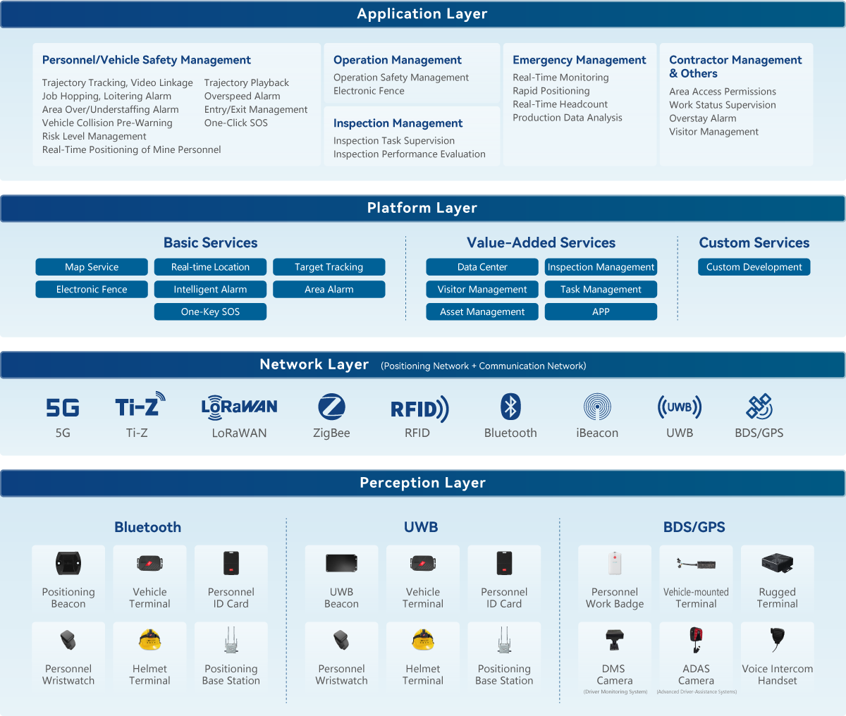
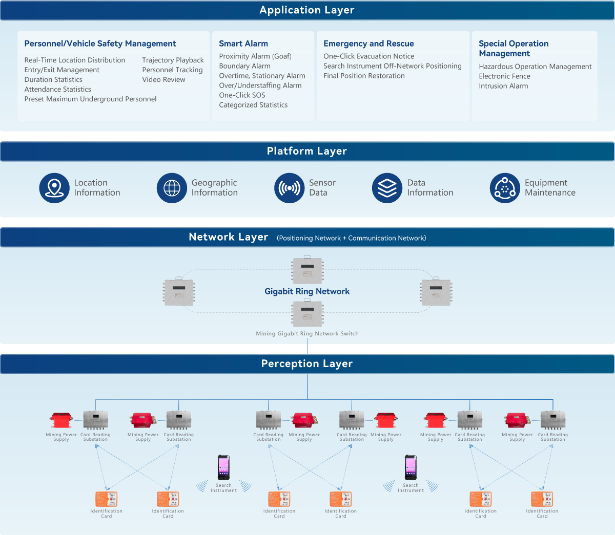
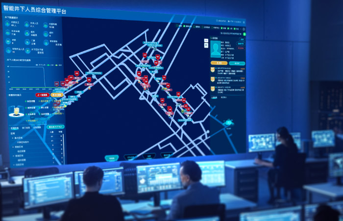
Monitoring Center - Real-time Dynamic Overview
- Underground data statistics, equipment status, area information, personnel information...
- Trends in personnel changes, real-time alarm display, dynamic trajectory tracking, behavior trajectory analysis...

Real-time Underground Monitoring
- Real-time distribution of personnel positions below ground
- Target tracking of underground personnel
- Playback of personnel activity trajectories
- Video-linked on-site viewing
- Underground personnel attendance statistics

Automatic Map Generation with Zero Maintenance
- In-house map engine supporting loading of various map data such as 2D/2.5D/3D
- Supports CAD format, user uploads, and automatic map conversion

Exceptional Alarm Management
- Virtual safety alert proximity alarms
- Overcrowding/understaffing/overtime/crossing boundary alarms
- One-click emergency SOS
- Alarm linkage with maps
- Categorized alarm statistics

Emergency Response and Rescue
- Instant evacuation notification to all
- Accurate rescue with final positions at specific times
- Efficient search and rescue with offline locator

Below-ground Management
- Setting maximum number of people below ground
- Setting duration for a single descent

Equipment Management
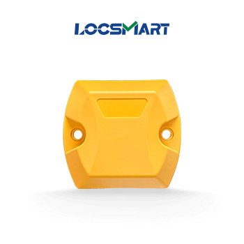
- Management of identification cards, video cameras
- Unique monitoring device management
- Substation management
Solution Architecture


Device Overview
- All
- Positioning Beacon
- Positioning Terminal
- Gateway
Tel:
+86-0512-65296869
Address
Building16,Creative Industry Park,No.328 Xinghu Street,Suzhou Industrial Park
